The DU Lounge
Related: Culture Forums, Support ForumsWile E. Coyote and the Roadrunner. Where?
Where did these two macchiavellian masterminds engage in their neverending battle of wits?
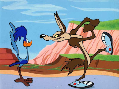

[font color="white"] . . . . . . . . . . [/font] meep meep


| 2 votes, 0 passes | Time left: Unlimited | |
| Utah | |
0 (0%) |
|
| Sonora | |
0 (0%) |
|
| Montana | |
0 (0%) |
|
| Nevada | |
0 (0%) |
|
| Arizona | |
1 (50%) |
|
| Colorado | |
0 (0%) |
|
| New Mexico | |
1 (50%) |
|
| Baja California | |
0 (0%) |
|
| Idaho | |
0 (0%) |
|
| 0 DU members did not wish to select any of the options provided. | |
| Show usernames
Disclaimer: This is an Internet poll |
|
 = new reply since forum marked as read
Highlight:
NoneDon't highlight anything
5 newestHighlight 5 most recent replies
= new reply since forum marked as read
Highlight:
NoneDon't highlight anything
5 newestHighlight 5 most recent replies

A HERETIC I AM
(24,382 posts)
Bucky
(54,106 posts)Surely that's not going to be as far north as Utah...
A HERETIC I AM
(24,382 posts)Some maps will show it entirely in Utah, but the road from Mexican Hat, Utah (So named for an interesting spire like formation that has at its peak, a large rock that looks like an upside down Mexican Sombrero) to Kayenta, AZ - US 163 - drives through a good portion of it.
Mexican Hat;

US 163;

Driven this way several times over the years. Here's a pic of one truck I drove along the Colorado, East of Moab, UT;

That shot is on Utah Rte. 128, between Moab and I 70. The Colorado River is to the right hand side of the truck, or behind it from the cameras perspective. The vertical portion of the cliffs behind the truck were, to my estimation, about 150 feet high.
This is about 225 miles north of the AZ line. I am heading toward Moab in that shot where I will turn south on US 191 toward Mexican Hat and the Valley. The entire area, Southern Utah and Northern Arizona is absolutely spectacular, with scenery that is, for lack of a better way of putting it, massive. The vistas and scale is hard to find anywhere else in the country.
Here is a thread I put up last year when I traveled from Phoenix to the Denver area through the 4 corners area;
DU2 and pic heavy
http://www.democraticunderground.com/discuss/duboard.php?az=show_topic&forum=439&topic_id=1104336

Stuart G
(38,458 posts)That is where the idea of falling off those huge ledges began..I suspect...(perhaps someone who really knows Chuck Jones's history
can tell for sure. Many films were made there, and in 1947 when the first RR cartoon was made it would be the place to use..
Huge rock formations that resemble the ones in the cartoons.
The part that is a park is ownd by Navajo Nation If I recall.
A HERETIC I AM
(24,382 posts)I've been through there several times over the years and it is indeed a spectacular landscape.

Broken_Hero
(59,305 posts)
Ptah
(33,057 posts)
Stuart G
(38,458 posts)sarge43
(28,947 posts)A map of their range


MiddleFingerMom
(25,163 posts).
.
.
... BOTH the Sonoran Desert in Arizona AND Monument Valley in Utah.
.
.
.
sarge43
(28,947 posts)the landscape gave so many opportunities for disasters.