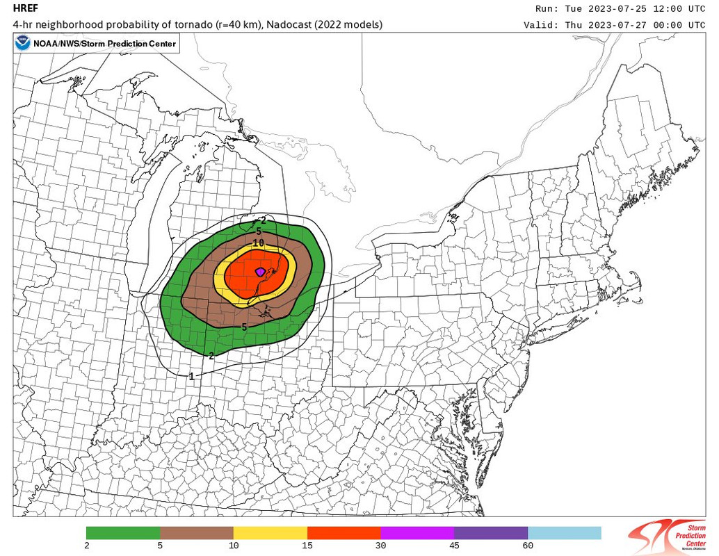
Heads up in central, south central and, southeast lower Michigan tomorrow.
Last edited Tue Jul 25, 2023, 04:45 PM - Edit history (2)
Edited to add: The Enhabced Risk is farther north now.


Area Forecast Discussion
National Weather Service Grand Rapids MI
334 PM EDT Tue Jul 25 2023
LATEST UPDATE...
Marine
.SHORT TERM...(This evening through Wednesday night)
Issued at 247 PM EDT Tue Jul 25 2023
...Severe Weather Wednesday...
While there is a chance for a few isolated showers this afternoon
and evening, the main focus of the next 24+ hours is the severe
weather risk for Wednesday. The Storm Prediction Center has
continued the Enhanced Risk for severe weather for Wednesday
afternoon and evening with those near and south of I-96 having the
greatest risk. Plenty of potential for damaging winds and a few
tornadoes though some questions do remain on whether that
potential will be realized for all of lower Michigan. Hail is a
lesser threat but still could be a concern in some storms.
At this time it still looks as through the worst weather can be
expected early afternoon through early evening with some hint
that the worst could develop near or east of US-131 and near/south
of I-96. Best wind profiles and the development of instability
should be better in southeast Michigan where more sunshine and
deeper southerly flow will be in place for much if not all of the
day. Supercells could develop at the onset of storms as a
shortwave moves across the state...with a more organized line of
storms late in the afternoon and evening as the storms progress to
the east/southeast. Limiting factor for further western
initiation will be how much cloud cover and/or lingering light
showers will be in place Wednesday morning over lower Michigan
from convection currently over the Dakotas.
With the southerly flow also comes a great deal of moisture
advection ahead of storms. Couple that with the potential of
the broader storm system pivoting over central michigan...and prolonged
periods of heavy rainfall may occur over the same areas. Generally
this type of set up means urban areas would be at most risk for
some flooding though any area that sees prolonged heavy rain could
see some localized impacts.